|
 |
 |
|
|
![]()
|
contact us: information@stlsoftware.net
A simple county or municipal mapping system designed to be integrated with personal property tax, real property tax, or other types of account information. This system comes with a basic map of your local area already built in, or it can be set up to access an existing local map. It is highly table driven, giving you the ability to control the appearance and information available for view. Satellite and aerial images can be easily added.
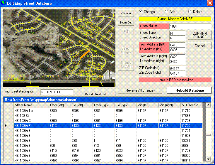
Several tools are built in which allow you to update the map, adding unique features or new construction. These can also be used in conjunction with images.
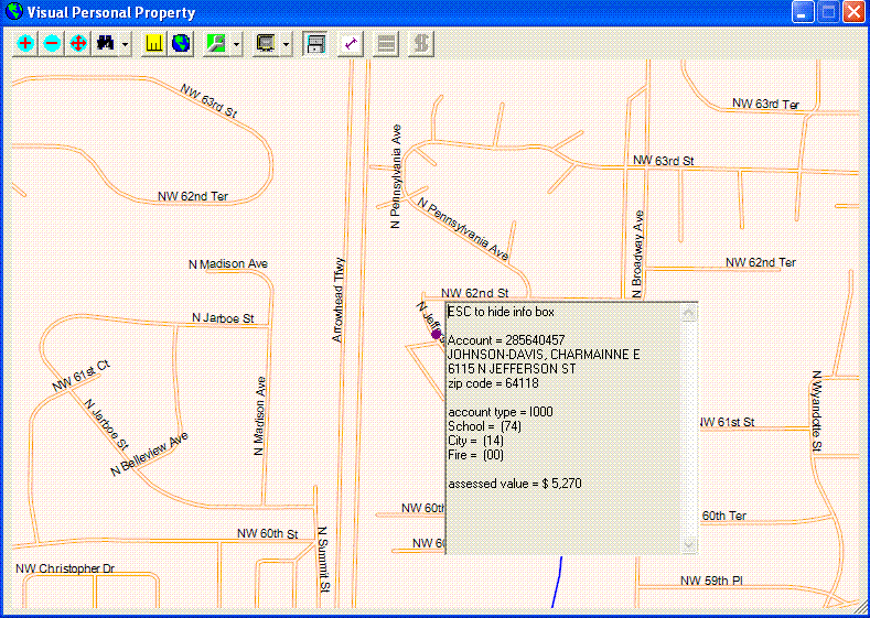
Many screens are provided to look up account or street information, or to display special features such as zip codes, school districts, business sites, or even individual residences. Each time, detailed data about any feature displayed is just a click away.
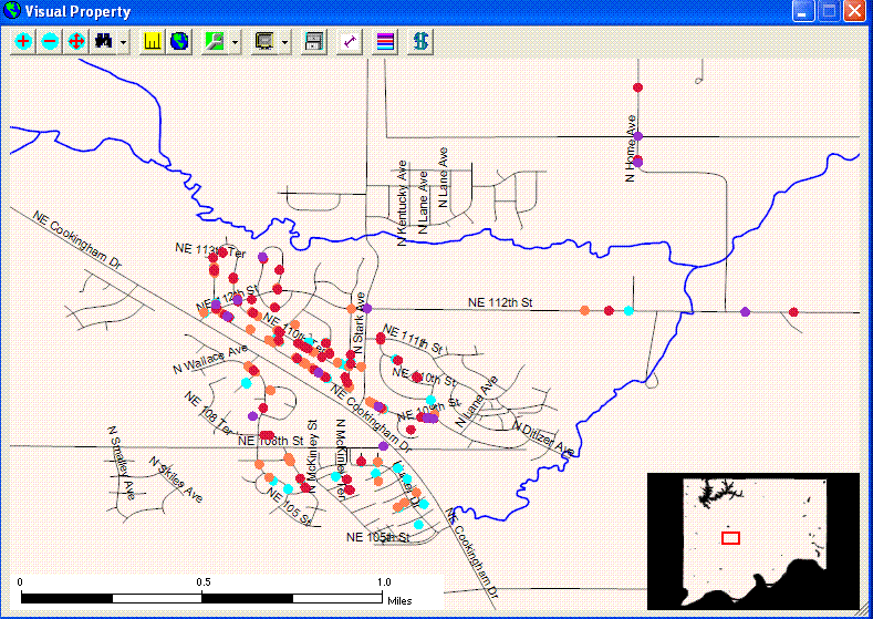
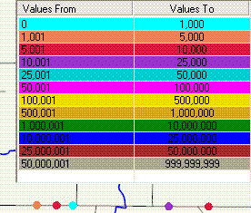
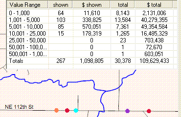
Demographic information can be displayed by taxing jurisdiction, account type (of your own design), account valuation, and more.
When used in this way, account information may be displayed using automatically generated tables. |